Check airspace advisories and restrictions in the Measure Ground Control Web Portal before heading out to fly
Understanding the Rules and Regulations
Measure has partnered with AirMap (www.airmap.io) to offer access to global airspace rules, advisories, regulations, and compliance information necessary to safely and legally operate drones. AirMap has partnered with transportation agencies around the world to bring you up-to-date airspace information which can be accessed directly within the MGC Web Portal and MGC Mobile Flight App.
It is the responsibility of the pilot to ensure they are flying within the rules and regulations laid out by the governing body with authority over their flight location.
The Airspace Map
The airspace map in the MGC Web Portal (Plan -> Airspace) can be accessed via the menu at any time, or via the Create/Update Mission form by pressing the Verify Airspace button.
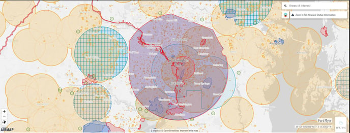
Zoom in and out by clicking on the +/- button or using your mouse's scroll wheel.
Clicking on the Globe icon will change the map base layer. Four base layers are available:
- Default (grayscale, light tint)
- Dark (grayscale
- Satellite View
- Traditional Map
Layers
- Clicking the Layers icon (image of layers icon) will show more information regarding rules and compliance in the area of focus as well as a broader overview of rules and laws for the country you are planning on flying in.
- Depending on country, some layers will be mandatory (e.g. FAA rules for UAS operations).
- Selecting optional layers will add or remove additional information regarding the airspace.
- Clicking the "i" icon will show more information regarding the layer.
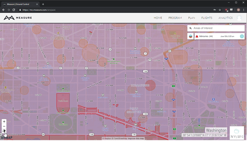
Airspace Advisories
- Advisories are based on the location of the map.
- Advisories can and will change over time. Be aware of temporary flight restrictions (TFRs) and NOTAMs for activity that may cause additional airspace restrictions, e.g. emergency response or military activities.
- For more information on advisories in your area, click Advisories and select the advisory to learn more about it.
- Users can also select items on the map for more information. A new screen will pop up showing more information regarding the area selected.
- For areas covered by the LAANC program (blue airspace partitioned into grids), users can use the MGC Mobile App to request authorization.
Additional Information
- The latitude/longitude of the center of the map will be displayed in the bottom right corner of the map.
- The current weather in the center of the map will be displayed in the bottom right corner of the map.
- The map is searchable by using the Areas of Interest search bar located on the top right side of the map.
Related Articles
Have questions or feedback? Please contact support.groundcontrol@ageagle.com