Request approval to operate in restricted airspace via the FAA LAANC program - Specific only to US-based operators
LAANC Overview
As of August 2022, LAANC Authorization directly via Ground Control is unavailable. Please use the Google OpenSky mobile application to perform LAANC Authorizations on your mobile device while in the field.
Please see this article to learn How to Request LAANC Authorization Using OpenSky
LAANC is short for Low Altitude Authorization and Notification Capability, an FAA program that runs in collaboration with approved UAS Service Suppliers (USS). LAANC provides access to controlled airspace near airports below approved altitudes in real-time via USS-developed interfaces. LAANC checks airspace authorization requests against a number of airspace data sources in the FAA UAS Data Exchange (TFRs, NOTAMs, etc.), automatically returning authorizations where permitted.
LAANC is available to pilots with valid Remote Pilot Certificates (LINK) who are operating in accordance with Part 107 rules. Recreational flyers can also access a limited version of LAANC.
Measure has partnered with AirMap, an FAA USS, to provide access to the LAANC authorization process via a mobile device. To request access via the MGC Mobile App, make sure to also install the AirMap app on the requesting device.
Airspace requests via LAANC are currently only available via the MGC Mobile App.
Requesting LAANC Authorization
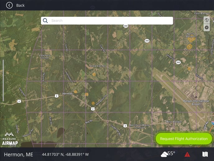
In the MGC Mobile App, open the Airspace Map and navigate to the location where the flights are going to take place. If the airspace is restricted but LAANC-enabled, the airspace will be overlaid by a gridded zone (blue by default), with max altitudes defined for each zone. To begin the LAANC process, press the Request Flight Authorization button in the bottom right corner.
The MGC Mobile App will attempt to open AirMap. If AirMap is not installed, an alert will prevent the user from proceeding. Otherwise, read the terms and conditions and press Accept to open the LAANC request feature in AirMap:
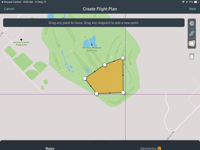
Use the mapping tool to select the area drone operations will occur. Once the flight boundaries are defined, press Next to fill out the submission form.
Note: For flight areas that are in two or more sections of a LAANC-enabled zone, the settings must comply with the requirements of the most restrictive section.
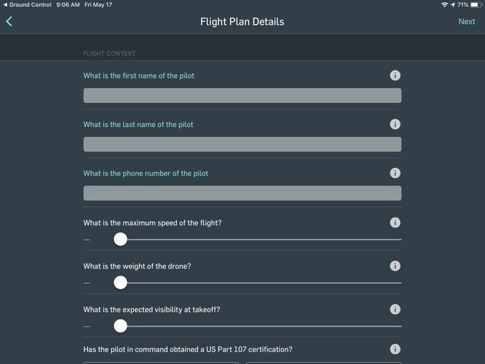
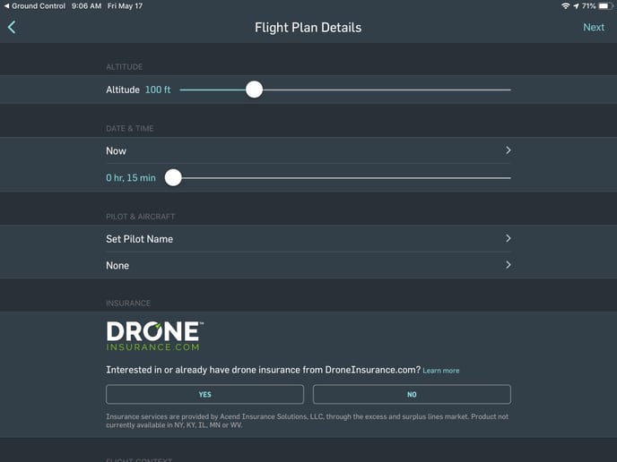
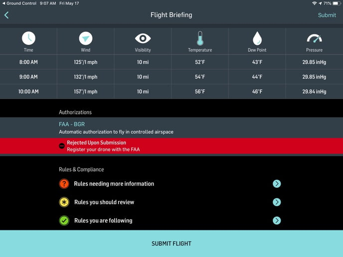
Once the form is complete, press Submit Flight to complete the request process. After a few moments, your flight plan will be approved or denied. Adjudicated flight plans will provide details into areas lacking in detail or that need to be revised. If your flight plan is rejected, review the details and resubmit once corrections have been made.
Note: Depending on the airspace restrictions in the flight zone, some drones may not take off even with LAANC authorization for the airspace. To unlock the aircraft, the pilot will need to request a GeoUnlock from DJI before commencing operations.
FAA Waivers
To help track any waivers that you may receive through LAANC or the FAA, we recommend attaching the waivers to the corresponding mission.
LAANC Authorization Example
Related Articles
- Airspace in the MGC Mobile App
- Recommended Third-Party Mobile Apps
- Requesting GeoUnlock for DJI Drones
Have questions or feedback? Please contact support.groundcontrol@ageagle.com