Measure Ground Control Allows For Users to Upload Existing Data Files
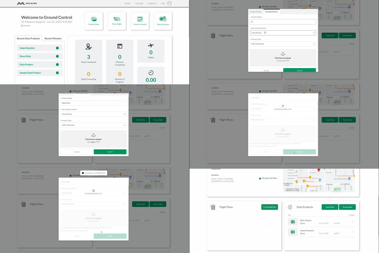
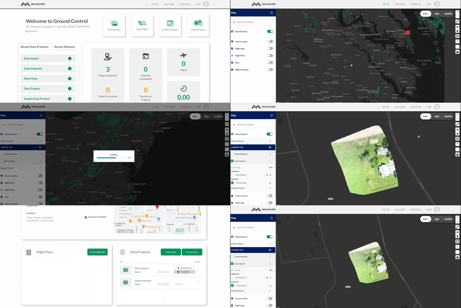
Users can import their existing GeoTiff files by using the Import Data feature in Mapviewer.
Getting Started

Users can only upload raster GeoTIFFs (RGB orthomosaics, multispectral reflectance maps, DSMs, and DTMs).
- Start by logging into Measure Ground Control
- Hover over Manage and select Data Products
- Click on Import Data
- Create a new mission or use an existing mission
- If creating a new mission enter the mission's information
- Enter the Data Product's name
- If using an existing mission select it from the drop-down menu
- Select the Product Type from the drop-down menu
- Click on the file upload box, find and select desired data product
- Select Submit and wait for the Successfully Uploaded Data message
Please note that users have the option to create a new mission or use an existing mission to import data products.
Related Articles
Have questions or feedback? Please contact support.groundcontrol@ageagle.com

