An Overview of how you can review, analyze and share different data products through MGC
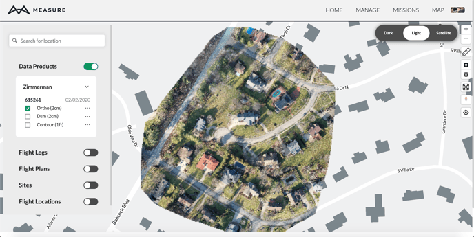
Once you Create a Map in Measure Ground Control, these data products will also be accessible in the MapViewer. Once you toggle on the data products tab, you will find a list of products sorted by date created, listed by your custom provided name, and filtered by the area showing on your map. Clicking on one will zoom you into that particular map. Keep in mind this is a tile service, so once you zoom, you do have to wait a bit the first time to allow it to tile. From here on, it'll be more snappy.
Through MGC, we provide you with options to view 2D and 3D data products through either the MGC web portal or Pix4D, access Measurement tools in both locations and download GIS-compatible file types for all products created.
2D Data Products
We provide customers with two options to visualize 2D data products in either the MGC portal or through the Pix4D portal.
From here, Data products can be exported as GeoTIFF (orthos and DSMs) or GeoJSON (contours) files for use across GIS software platforms common in construction, asset management, and survey-related work.
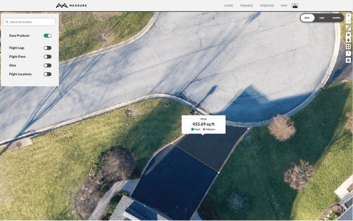
Measurement Tools
You can use the line and area measurement tools on the right-hand side of the screen to conduct further analysis.
- Line measurements: click the ruler icon, click once on the map, and any number of additional times to get measurements. Click the ruler icon again to close the line measurement tool.
- Area measurements: click the square icon, click the map once and any number of subsequent times with the last click a prior point to calculate the area. Click the trash icon to close the area measurement tool.
3D Data Products & Share Link
When you process data through MGC, the processing engine (Pix4D) is also creating 3D data products, which you can access by clicking on the three dots next to your project name. You'll have the option to View the Point Cloud in Pix4D, Copy Pix4D Share Link, and Download 3D Mesh Bundle.
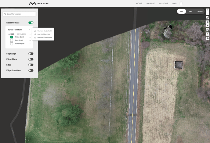
Keep in mind, that the Pix4D share link will not require a password, so the link should only be shared with those you trust. The 3D Mesh Bundle is a (.zip) that consists of 3 files:
- .obj - The OBJ file format is a simple data format that represents 3D geometry. Once downloaded, the .obj file an be opened with various tools like Meshlab, Global Mapper, Rhino, 3ds Max, 3DBuilder , Autodesk Maya, and even previewed with Apple Preview.
- .mtl - The Material Template Library format (MTL) is a companion file format to .OBJ that describes surface shading (material) properties of objects
- .jpg - RGB image with the values for each pixel of the triangles that form the 3D Textured Mesh
NOTE: All 3 files for the 3D Mesh must be stored in the same location and the names of the files should NOT be changed in order to view the 3D mesh properly.
Related Articles
Have questions or feedback? Please contact support.groundcontrol@ageagle.com