Terrain Following allows your drone to automatically adjust altitude during grid flights based on current elevation using a preset tolerance level.
Setup
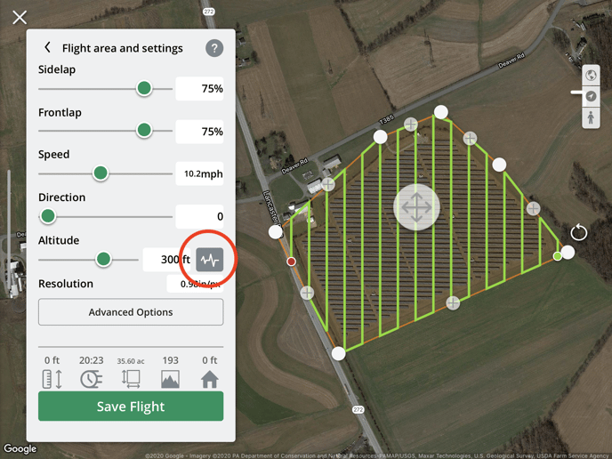
To start using Terrain Following set up a grid flight plan in the Flight Plans tool. You'll now notice a terrain icon next to the altitude setting. Tap this to turn on Terrain Following and adjust tolerance.
Note: You must have an internet connection to enable Terrain Following, but once
you've turned it on, tap Save Flight to cache the terrain data, so you can use it with your
flight while offline!
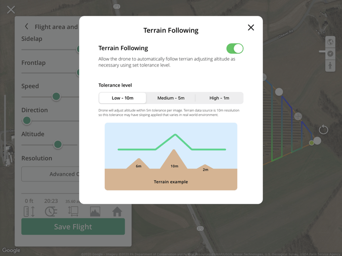
By default, tolerance is set to High - 1m. This drone will adjust altitude within a meter tolerance per image. There are additional tolerances available to reduce this sensitivity.
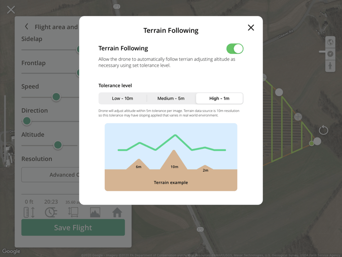
Please note the terrain data source is 10 m resolution so tolerances may have sloping applied that varies in real-world environments. Please use caution when using this feature. You can find more info on our data source from https://www.mapbox.com/about/maps/ under Data Sources: MapBox Terrain
Starting Point Considerations
If the starting waypoint of the grid flight is higher in elevation than the home point, the drone will rise to the flight plan altitude + the difference in elevation between the first point and the home point.
Example: Your flight plan altitude is set to 100 m, and your starting waypoint is 200 m higher in elevation than the home point. The drone will rise to 300 m AGL and then fly to the starting waypoint. This could potentially be an airspace violation in certain jurisdictions; Please be mindful of any airspace altitude restrictions.
If the starting waypoint of the grid flight is lower in elevation than the home point, the drone will rise to the flight plan altitude, fly to the starting waypoint, and then lower itself to the set flight plan altitude, relative to the starting waypoint.
Example: Your flight plan altitude is set to 100 m, and your starting waypoint is 200 m lower in elevation than the home point. The drone will rise to 100 m AGL, fly to the starting waypoint, and then lower itself from the now 300 m AGL to 100 m AGL. This could potentially be an airspace violation in certain jurisdictions; Please be mindful of any airspace altitude restrictions.
Ready to fly
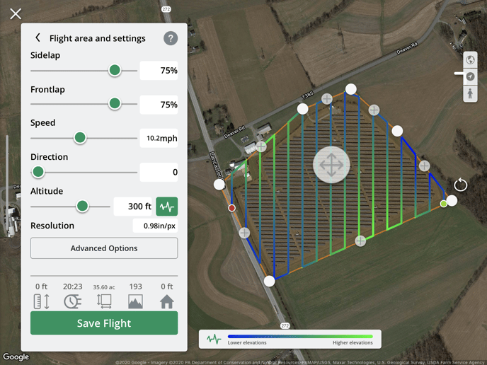
With Terrain Following on, the grid color will be automatically updated to reflect changes in elevation. Green indicates higher elevations and blue indicates lower elevations.
Tap Save Flight to save your flight plan, or if connected to a drone, tap Save and Fly to start.
Safe flying!
Please note Terrain Following is only available for grid flight plans
Have questions or feedback? Please contact support.groundcontrol@ageagle.com